
Andorra Ultra Trail 2014
Andorra Ultra Trail 2014 - Ordino, Andorra
Note: "Andorra Ultra Trail 2014" is NOT organized by goandrace.com
Information about Andorra Ultra Trail 2014
Running event name: Andorra Ultra Trail 2014
Date and Time: Thursday, July 10, 2014
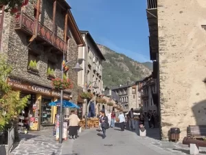
City: Ordino
Address:
c/o:
Country: Andorra
Latitude and longitude: 42.555655 1.533073
About the event:
Ronda dels Cims:
170 k ( 106 mi.) 13,000 meters (8 mi.) of elevation gain and 13,000 meters (8 mi.) of elevation loss.
Giant route around the whole Principality of Andorra, including a visit to its highest point, Comapedrosa at an altitude of 2,942 metres. In the light of the full moon on the longest days.
Mitic:
112 k (70 mi.) 9,700 meters(6 mi.) of elevation gain and 9,700 metres (6 mi.) of elevation loss
A trip around the whole of the Principality of Andorra, including a visit to its highest point, Comapedrosa, at an altitude of 2,942 metres, and other iconics peaks. In the light of the full moon on the longest days.
Celestrail:
83 k ( 50 mi.) 5,000 meters (3 mi.) of elevation gain and 5,000 metres (3 mi.) of elevation loss
A beautiful loop of 50 miles, particular and wild but where there are some sections charmingly hilly to recover after three big passes in more of 2,500 m of height.
2014 Trail:
40 k (25 mi.) with 2,900 meters (1.8 mi.) of elevation gain and a 2,900 meters (1.8 mi.) of elevation loss
A dream trail featuring magnificent scenery with spectacular views, a discovery of our Valls del Nord (Northern Valleys)
Solidaritrail:
10 k (6,2 mi.) with a climb of 750 meters (2460.629 ' mi.) of elevation gain and 750 meters (2460.629 ' mi.) of elevation loss
Fun walk, open to everyone, including people with disabilities
Other notes:
Virtual Race? No
Trail? Yes
Cross country event? No
Multi-stage event? No
Initiatives for children and families: No information
How to apply and entry fee:
Award Description:
Dressing rooms:
Aid stations:
Website: www.andorraultratrail.org/
E-mail:
Flier: Not available
Final ranking: Not available
Andorra Ultra Trail 2014 course map
| # | Length | Race type | Course map and gpx file | Terrain type |
|---|---|---|---|---|
| Race 1 | 170 km (105.7 mi) |
Ultramarathon | Not available | Not available |
| Race 2 | 112 km (69.6 mi) |
Ultramarathon | Not available | Not available |
| Race 3 | 80.5 km (50 mi) |
Ultramarathon | Not available | Not available |
| Race 4 | 40 km (24.9 mi) |
Competitive race | Not available | Not available |
| Race 5 | 10 km (6.2 mi) |
Non-competitive race | Not available | Not available |
Ordino weather forecast
Other nearby races
Events on the same day at a distance of less than 50 km (31 from Ordino as the crow flies are reported here.
No running race found within 50 km.
Message for running race organizers
Are you part of the organizing committee of the running event
named Andorra Ultra Trail 2014
and would you like to be the one to manage the information, adding more details?
Register (if you have not already done) and log-in to see here the link to forward the request to Go&Race administrators.
Registration on Go&Race and event management are completely free. There are no paid services on Go&Race.